
Another heatwave set to sizzle and it won't be the last this year
The UK has had 20 per cent of its average July rainfall.
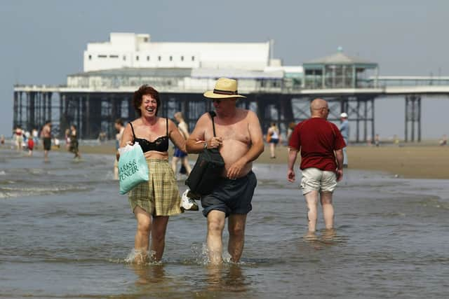
A fourth heatwave is expected to hit the UK as wildfires tear through parts of the country.
Homes were evacuated as a blaze swept through the Cairngorms National Park in what Police Scotland declared as a major incident, and emergency crews continued to tackle wildfires in Wales.
North Wales and the Upper Severn became the first part of the UK to declare drought status on Thursday, and parts of Exeter, Devon and Usk in Wales met their heatwave thresholds for 20 consecutive days.
No rain has fallen in July in Bedfordshire, Buckinghamshire, Hertfordshire and West Sussex, and 16 counties have recorded 0.1mm, which “might just be a bit of dew on the grass”, said the Met Office’s senior operational meteorologist Marco Petagna.
The UK has had 20% of its average July rainfall, which takes into account the wetter areas.
It is “very, very unusual” for a hot and dry spell to last this long, Mr Petagna added.
The dry conditions follow last year’s drought summer, as the UK faces more extreme weather fuelled by human-caused climate change, mostly from burning fossil fuels.
Heat alerts are in place across parts of England with officials warning that temperatures are likely to impact on health and wellbeing.
Cooler and fresher weather is expected widely on Sunday, ending the longest running heatwaves with highs of 25C and 26C possible in the South East and high teens and low 20s more widely elsewhere.
But the heat will climb again at start of the week, with Monday’s high forecast at 27C in the South East, just below the area’s heatwave threshold of 28C.
Heatwave thresholds will start to be topped the following day, with highs of more than 30C expected until Thursday in the South East.
Next week’s heatwave may not be the last of the summer, the Met Office’s long range forecast suggests.