
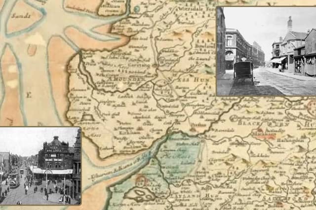

The information about Blackpool's very early days, it's roads and buildings is limited, but what we do know is that it wasn't until the mid-1700s that Blackpool began to take shape. It's main building boom was in the 1800s and early 1900s.
The earliest tracks linked Preston with the Fylde through marsh land. According to local historians, in October 1655, the people of Great and Little Marton petitioned for permission to build a bridge over the outlet from Marton Mere to the sea – was that bridge the first thoroughfare?
In later years, Blackpool gained access to the wider county via a private road constructed by Thomas Clifton and Henry Houghton, which began in 1721. The town centre’s development started with Lane Ends Hotel, Foxhall, Metropole and Clifton Hotels.
These photos delve into the history of our town’s roads. They were early buildings and were no doubt central to how Blackpool shaped up. On the fringes of the town, The Manchester was an early one, so was Raikes Hall and Uncle Tom’s Cabin. Thanks to Ordnance Survey maps beginning in 1840 we have pieced together how the town centre sprawl began.
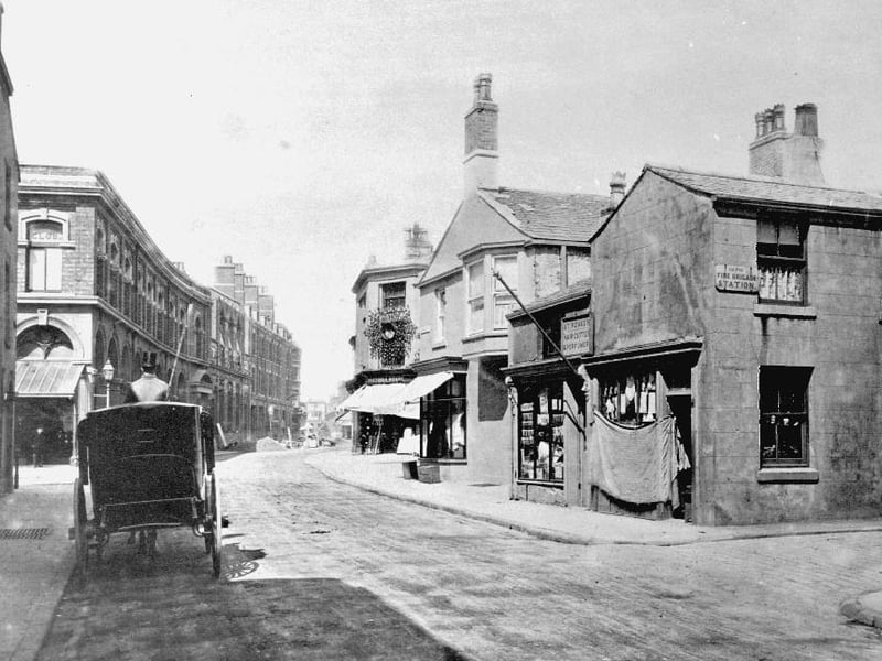
7. Bank Hey Street, 1875
Another of Bank Hey Street in 1875. The shop on the right has a primitive sacking blind. Lewis's department store was later built on the left Photo: National World
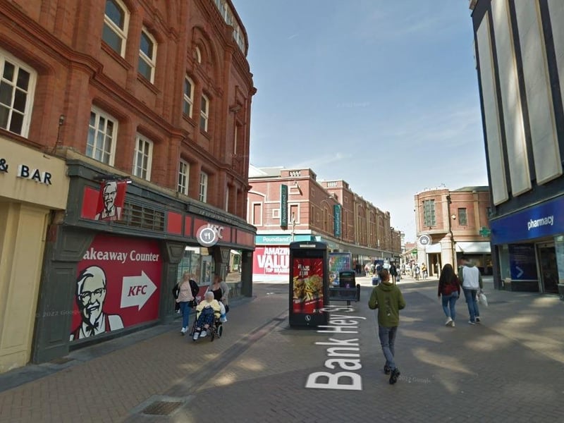
8. Blackpool's First Streets
Bank Hey Street taken from a similar angle in 2019 Photo: Google
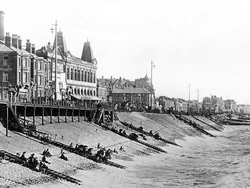
9. The Promenade 1840-1880
This photo of the promenade was taken in 1891, It is pre-tower days and pictures of this era are rare. The large building with "turrets" is the Prince of Wales Theatre, Market and Baths, later the Palace Theatre. Naturally drawn to the sea, the promenade was one of the first roads to be constructed and is visible on early maps dating back to 1840 Photo: Archive
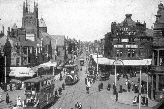
10. Talbot Road, 1840-1880
Talbot Road features on one of the earliest maps of Blackpool. It's length runs alongside Blackpool Railway Station towards Little Layton, as it does today Photo: National World
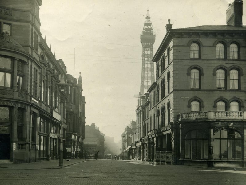
11. Market Street, 1840-1880
Market Street as seen from Talbot Square appears on early maps. The Clifton Hotel is on the right and beyond the cyclist (with what appears to be a plank across his back ) there is a stall on the corner of the old St John's Market. On the left is the Williams Deacons Bank which is now part of the Town Hall. This was probably 1920s Photo: National World
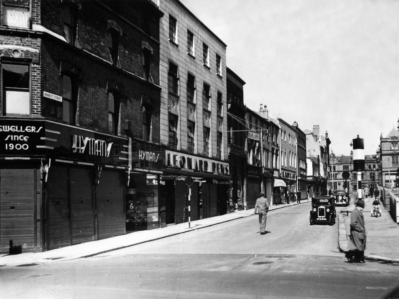
12. Market Street
Market Street taken from the south end of the street. This 1953 photo shows Hymans and Leonard Dews jewellers on the left and the site of the old St John's market just visible on the right where BHS would be built Photo: Submit