When the weather is set to improve in Blackpool after Storm Ciarán brought strong winds and heavy rain to UK
and live on Freeview channel 276
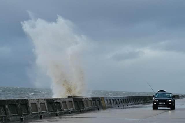
The third named storm of the season continued to batter the country on Thursday (November 2), bringing power cuts, travel chaos and school closures.
Gusts of more than 100mph and heavy rain hit the south of England and the Channel Islands, with residents in Jersey also having to evacuate their homes.
Advertisement
Hide AdAdvertisement
Hide AdMeanwhile, a tornado warning was issued by the Tornado and Storm Research Organisation (TORRO), which said the highest risk of a tornado would be across South Wales to London.
While no weather warning covered Lancashire, the county was certainly not immune to the effects of the storm, with heavy rain and strong winds present for most of the day.
But when is the weather set to improve?
Here’s the weather forecast for the rest of the week:
Friday (November 3)

Blustery showers continuing on Friday, though these turning lighter and more scattered with time.
Remaining windy around coasts, but winds gradually easing throughout the day.
Maximum temperature 12C.
Saturday (November 4)
Advertisement
Hide AdAdvertisement
Hide AdLargely dry to start on Saturday with cloud thickening through the day.
Outbreaks of rain moving northwards later, heaviest and most persistent in the south.
Rain predicted between 11am and 6pm.
Highs of 9C and lows of 8C.
Sunday (November 5)
Partly cloudy changing to sunny intervals by late morning.
Rain predicted between midday and 9pm.
Highs of 11C and lows of 8C.
Monday (November 6)
Partly cloudy changing to light showers by late morning.
Rain predicted between 9am and 3pm.
Highs of 11C and lows of 8C.
Tuesday (November 7)
Partly cloudy changing to light showers by late morning.
Highs of 11C and lows of 7C.
Wednesday (November 8)
Heavy rain changing to cloudy in the afternoon.
Highs of 11C and lows of 8C.
Thursday (November 9)
Cloudy changing to heavy showers by lunchtime.
Highs of 10C and lows of 8C.