VIDEO: Mystery over formation of new Fylde coast island


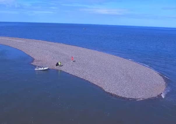
A bank of shingle and stone has emerged from the sea and appears to be a permanent addition to the geography of the area.
Various theories abound as to its origin – ranging from a shift in the natural sediments to the resurfacing of stones from an ancient Roman port.
Advertisement
Hide AdAdvertisement
Hide AdPhil Hodgson and Joe Helme of Fleetwood-based Vision Air filmed the island using drones after being taken out to the site, around two-and-a-half kilometres off Fleetwood’s north shore, by Paul Ashworth of Fleetwood Lifeboat Station.


They carried out a full survey which shows the strip of land is 638 metres long, 10.2 metres high and 3.4 hectares square.
Phil said: “Even at a normal high tide there is still a land mass visible.
“No-one can say why it is happening. The first thing you do is think about what is changing – the estuary doesn’t get dredged any more as there isn’t the same shipping traffic going into Fleetwood.
Advertisement
Hide AdAdvertisement
Hide Ad“We also have the wind turbines which have been built. Some people think maybe it is just returning to its natural state.


“It is made up of shingle and stone and at the moment there is no vegetation.
“It has grown in quite a short time.
“The last time we did the RNLI wreck treck about three years ago, it wasn’t there.”
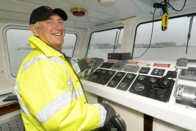
Tony Cowell, second coxswain on Fleetwood Lifeboat and captain of the Fleetwood to Knott End Ferry, said he had been noticing changes for the past 10 years.
Advertisement
Hide AdAdvertisement
Hide AdHe said: “Admiralty charts from 1700 show there has always been a bank which is called Kingscar Bank, but nothing has been visible like it is now.
“It is amazing. It is all stones and there have always been stories that there was a Roman port at Fleetwood.
“In the 1960s, divers went down to have a look.
“To the other side of the bank is Lune Deep which drops straight down to 60ft.
“I think the island is going to get bigger and bigger. Now you can see it even on a 10 metre tide.”
Advertisement
Hide AdAdvertisement
Hide AdJoe piloted the drone which enabled the Vision Air team, who are accredited by the Civil Aviation Authority, to take around 200 photographs of the island during a survey on April 23.
There is a sandbank to the south side, water to the north and it is between 10 and 15 metres at the widest point.
Now Phil and Joe, whose business aims to focus on aerial inspections and civil surveys, hope to continue to measure the growth of the land mass.
While there is strong interest in the new island, people are being warned not to go out to it.
As for claiming ownership the land is easily within UK territorial waters which stretch to just under 14 miles.