Swooping down on the Fylde of the past


But even more so when viewed from the air.
These aerial shots, taken throughout the last century, show areas of Blackpool, Fylde and Wyre from a bird’s eye view.
Seeing the Fylde coast from this different perspective can really highlight how different it looked in years gone-by and how much change – or in some cases, little change – to the landscape has taken place over the decades.
Advertisement
Hide AdAdvertisement
Hide AdA rare aerial view of South Shore, taken in 1934, shows a the vast expanse of undeveloped land in Harrowside. It was taken before the Solarium was built on the empty plot, and when the Marine Promenade, opened in 1926, boasted sunken gardens – a rock garden with a stream, ornamental fountains and a yachting pond or paddling pool.
Another aerial view is of the Pembroke National Gardens, the land once next to Derby Baths at North Shore, which was part of the Pembroke Estate and is now the site of the Blackpool Hilton. Derby Road is to the right of the plot and Dickson Road above it, the regimented streets beyond have changed little since this photograph was taken in 1964.
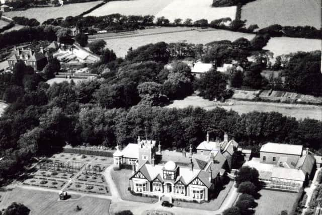
The house known as Illawalla, on Skippool Road, Thornton, once home of Sir Frederick Emery and then a nightclub, is shown on one aerial photograph.
And an undated aerial picture, from our archived glass negatives, shows railway sidings attached to Blackpool Central Station. Coop Street on the right runs almost parallel with the railway lines.
Advertisement
Hide AdAdvertisement
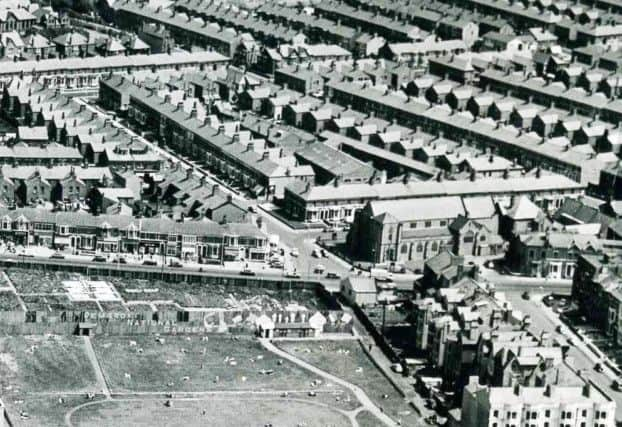
Hide AdThe Majestic Ballroom with three distinctive gable ends and light coloured roof is in Bathesda Road. Kent Road dog-legs in the bottom left to centre left and Central Drive runs from centre left to top right, passing the open ground at Revoe on the left.
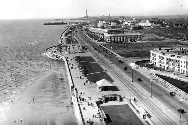
The heart of Blackpool is the focus of an undated aerial view from Blackpool Tower, looking north. It looks to be from perhaps the 1930s.
In the centre, Market Street can be seen, running parallel with the Promenade and Corporation Street on the right. The long roofs of the old St John’s Market and Boots Chemist can also be seen in the centre of the picture, with the town hall and Yates’s Wine Lodge at the top.
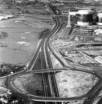
Moving out of Blackpool centre, Yeadon Way, Blackpool, can be seen in an aerial shot, looking west from the M55 roundabout. It was opened in January 1986.
Advertisement
Hide AdAdvertisement
Hide AdThe road follows the old railway line to the site of Central Station and is named after Lancashire County Council surveyor Harry Yeadon.
Moving up to Fleetwood, the now-lost Fleetwood Pier can be seen pictured in 1950.
And Fleetwood Docks can be seen, back in 1975.
Also long gone, Lytham Pier is shown in 1940. The pier, designed by Eugenius Birch, as the first pleasure attraction in Lytham, opened in 1865.
It fell into disrepair after a severe fire in 1928, which burnt out the pavilion and left extensive damage. It was eventually demolished in 1960.
And Fairhaven is shown on the final aerial photograph here, with its distinctive “White Church” – Fairhaven United Reformed Church – clearly visible.