Easter 2024: Wacky weather on the way for half term break - this is when it will be dry
and live on Freeview channel 276
Easter is nearly upon us, and so is a fortnight of very changeable weather.
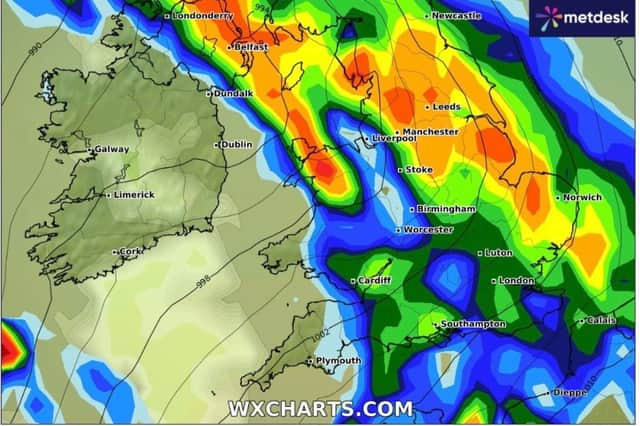
After a wash-out start to the year, many of us have been hoping for a drier and warmer time this Easter - but it's not going to be quite that. According to the latest information on WX Charts, we're in for both extremely wet and dry spells -with temperatures varying from highs of 12.4 degrees celcius on Easter Sunday to lows of -1 within days. There could even be snow.
Advertisement
Hide AdAdvertisement
Hide AdEaster weekend
So far, Good Friday is looking wet for Lancashire, with rainfall expected mainly in the afternoon. But by the evening, the rain will stop and it will be dry until the early hours of Monday, when a band of rain moves up from the South East.

Snow
Monday night into Tuesday looks very wet, but Tuesday as a whole looks like it will be dry. Wednesday is a different story. Prepare for heavy rainfall most of the day - and maybe even snow in the afternoon in Pennine and northern Lancashire areas.
Thursday is likely to be wet, but followed by a much drier Friday. On Saturday, April 6, charts show the whole of Lancashire covered in a heavy band of rain, with up to 5mm of rain falling every hour. This should move on by the evening, with the county remaining much drier until Tuesday afternoon, when yet another band of rain moves north and doesn't clear until Thursday. From that point on - the end of the Easter half term, the weather looks much drier.
Advertisement
Hide AdAdvertisement
Hide AdSign up for our free newsletters now What do the MET Office say?
Met Office Deputy Chief Meteorologist Helen Caughey said: “Showers will continue into the weekend, especially for southern and western areas. However, it is likely that we will see something of an improvement for most areas, with showers tending to become less frequent, and a better chance of longer spells of sunshine for eastern and northern areas, especially on Sunday.
“It will also become less windy, and temperatures should start to trend upwards, feeling quite warm in any sunshine. However, more widely unsettled conditions look likely to return into Easter Monday, but there is still some uncertainty in the timing of this deterioration.”
Think about driving conditions
RAC Breakdown Spokesperson Rod Dennis said: “With plenty of classic early spring weather over the Easter bank holiday weekend – showers and gusty winds along with some brighter interludes – drivers getting away will definitely need to be on their guard and ready to cope with rapidly changing road conditions. Slowing down in the heaviest of downpours on Good Friday and Easter Saturday is a must as stopping distances will be far greater.
Advertisement
Hide AdAdvertisement
Hide Ad“It’s vitally important drivers don’t travel through any standing water at speed, however shallow, as this dramatically increases the risk of aquaplaning and losing control of their vehicles. When it comes to an easier time on the roads, Sunday could be drivers’ best bet before the weather deteriorates once again on Easter Monday. As the weather over the weekend is so changeable, it’s also a good idea to have sunglasses to hand to make driving safer when the sun makes an appearance and causes wet roads to dazzle.”
Comment Guidelines
National World encourages reader discussion on our stories. User feedback, insights and back-and-forth exchanges add a rich layer of context to reporting. Please review our Community Guidelines before commenting.